Development in Toronto Part I – Railway Lands
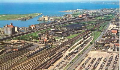
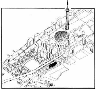
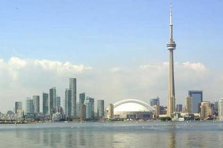
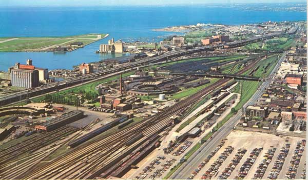
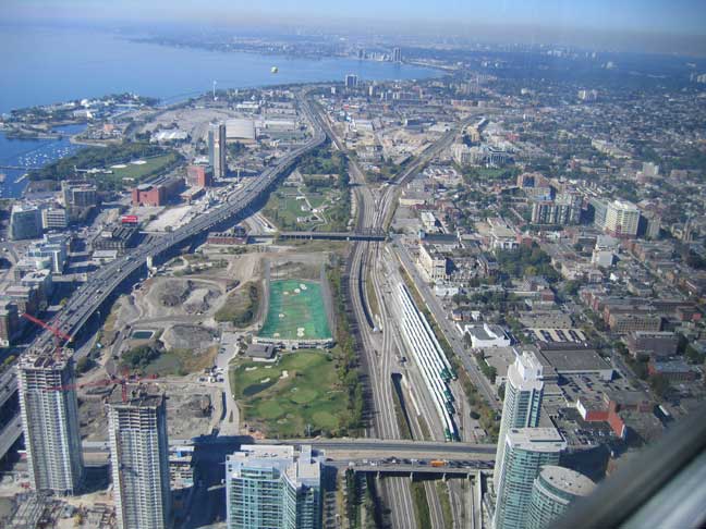
Ever get really pissed off trying to find out what the hell is going on (development-wise) in one of Toronto’s several large development projects? We’re talking showcase large scale urban brownfield sites, the likes of which – once developed – we will rarely see again, such as the Massey-Harris/Ferguson lands, the Inglis lands, and the Railway lands (shown above before the yards, and western roundhouse were removed). Now, you might think that a simple visit to the City of Toronto’s website would clarify the matter – especially for a location as fundamentally important as the railway lands. Perhaps the Planning Department would give us a clue? Nope. Do a search for Railway Lands. Aha! So here we have the Urban Design Guidelines for the Central/West Railway Lands (but just try getting there from the Urban Design page). But of course, urban design guidelines are a relatively toothless mechanism to control development (something that’s being addressed with recent proposed changes to the Planning Act, Municipal Act, Provincial Policy Statement, and Ontario Municipal Board, see Ministry of Municipal Affairs and Housing who do a great job at clearly explaining all of their work) so how do we know that what they show is what we’ll get?
Now we all know that there are comprehensive plans done for all these areas just so the developers can ever get approval. At some point no doubt there were public meetings at which the plans were shown – but where the hell are these things now? Shouldn’t people be able to see the shape of the city to come, even if they didn’t happen to be at the one or two public meetings? Wouldn’t it be helpful, informative, and simply good public policy to keep the citizens of Toronto aware and on-board – especially when the projects are large to the point of being virtually sensational? Isn’t this where the dialogue about how to make a good city, how to grow responsibly and in a way that adds to the quality of the city, should be taking place? Maybe the developers don’t want anyone to know their detailed plans? Maybe noone thinks that anyone cares once all the planning’s done? Think again.
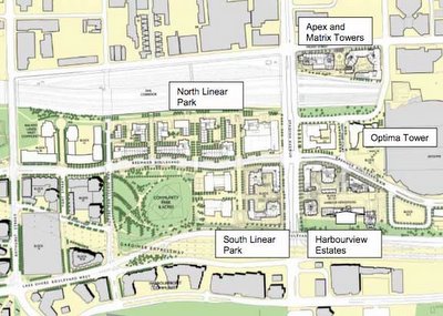
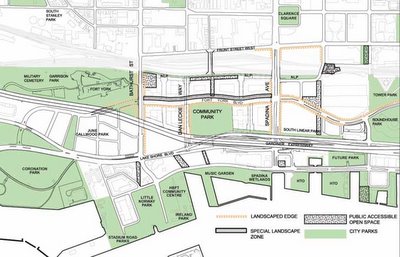
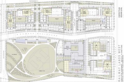
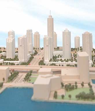
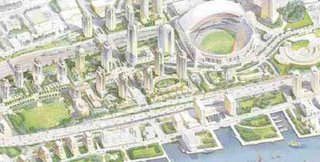
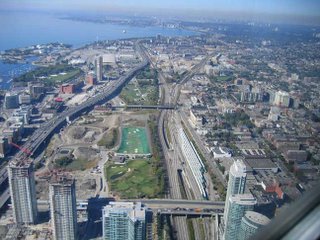
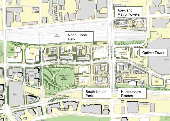
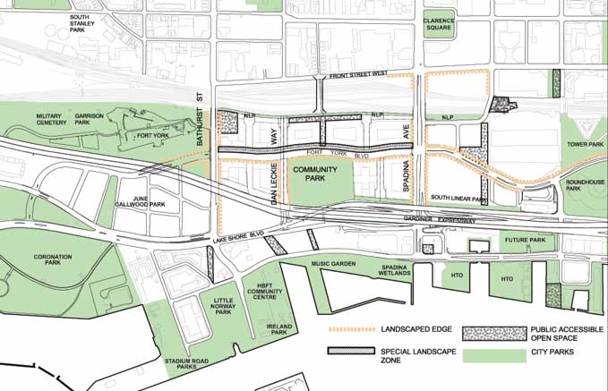
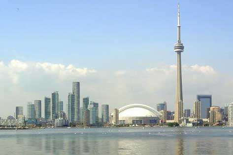
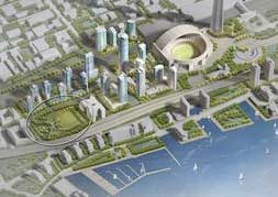
Given the disappointing results of the first phase of CityPlace (Central Railway Lands) one would think the City would be at pains to be more up front about what’s happening. On the other hand, you would think that they would be delighted to be giving out information on successful large scale development on important sites in the city. Sure the CityPlace: Railway Lands West Public Realm Master Plan, Architectural Guidelines and Implementation Plan got an honourable mention at the 2005 city urban design awards in the visions and master plans category (see here, but the real question is, did it deserve it) – but wouldn’t it be nice if uptodate information about the detailed design of this stuff as it will actually be built was continually available? It could be that I’m just slow and can’t find the information that is plainly on the City’s website. Just in case anyone else has the same trouble as me – here’s a few snapshots of what to expect in the West Railway Lands. If you don’t read plans well, or can’t picture what’s going on – tough. I challenge you to find anything better – and secretly hope you do! The two 3d images below are probably well out of date. In the detailed plan below, the block directly east (to the right) of the community park will house public schools (public and separate) and a community centre/daycare (all up against the east-west street, Fort York Boulevard). South (below) the schools buiding is an “affordable housing” complex which appears to be peculiarly isolated from all public right of ways, serviced by what looks like a private road. Why on earth we are we still building affordable housing in isolated separate buildings? Why can’t units of affordable housing be distributed individually in market-rate buildings the way it is proposed to be done in Regent Park? Anyways, somehow it all looks a little thin on the ground to me – especially for a site that on the whole particularly suffers from a physical isolation from the rest of the city, jammed as it is between the railway corridor and the Gardiner Expressway.


No Comments so far
Leave a comment
Leave a comment
Line and paragraph breaks automatic, e-mail address never displayed, HTML allowed:
<a href="" title=""> <abbr title=""> <acronym title=""> <b> <blockquote cite=""> <cite> <code> <del datetime=""> <em> <i> <q cite=""> <s> <strike> <strong>