Urban Fabric & Form Comparison
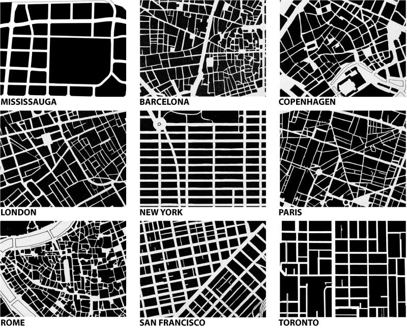
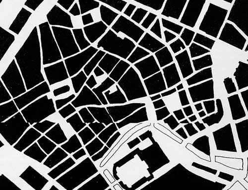
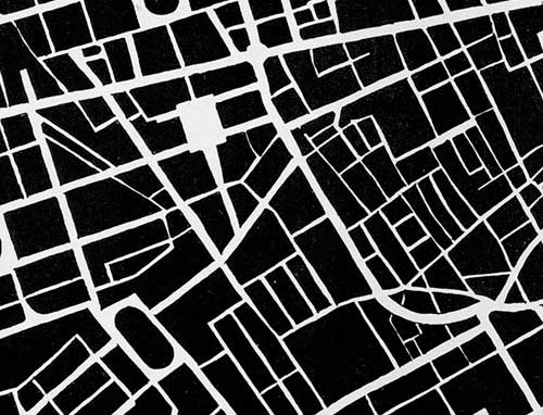
The Star today published a cover story (Beyond Density) in their Condos section on the efforts in Mississauga to create a more vibrant and pedestrian-friendly downtown – key among the problems identified has been the large scale of the block patterns in Mississauga – to prove the point the article includes urban form/fabric drawings of 9 cities (one hopes at the same scales) in order to compare the scales of the fabric of the street network. I include the drawings below alphabetically (with Mississauga first).
(edit: a friend requested I lay out all the drawings in a grid for easier comparison – I hope you enjoy – click on the above image for a larger version)
More than anything, the comparisons expose the inherent problems of scale in trying to evolve any suburban, auto-oriented area into a more pedestrian-oriented centre. The traditional response in suburbia has been to internalize pedestrian areas (in the form of the mall), Square One (home to the largest Walmart in the world) being a particularly powerful example, though Scarborough Town Centre might be the more classic one. The size of Square One’s block makes a very interesting comparison with Copenhagen’s city centre (3rd below) in which a series of streets and spaces have been linked together and pedestrianized (view a map of the pedestrian areas of Copenhagen from Metropolis magazine). In size or length of pedestrian space, the two might even be close, but in overall character and degree of integration into the urban fabric (particularly important for pedestrians) they are from wholly different worlds and you can easily trace much of these differences to the scale of the street fabric.
The other striking lesson from such comparisons is that there really is no perfect form of street fabric – many different networks and patterns are capable of producing wonderful places and being friendly for pedestrians as long as their fabric allows frequent and comprehensive linkages – there simply seems to be an upper scale beyond which all hope of efficient (and therefore popular) pedestrian circulation is gone.
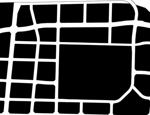
MISSISSAUGA: “Long blocks and virtually empty sidewalks”
BARCELONA: “La Ramblas is the main north-south promenade”
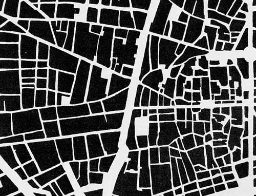
COPENHAGEN: “City features a car-free zone called the Stroget”
LONDON: “The Mayfair and Soho districts south of Oxford St”
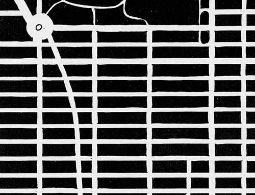
NEW YORK: “Midtown Manhattan south of Central Park”
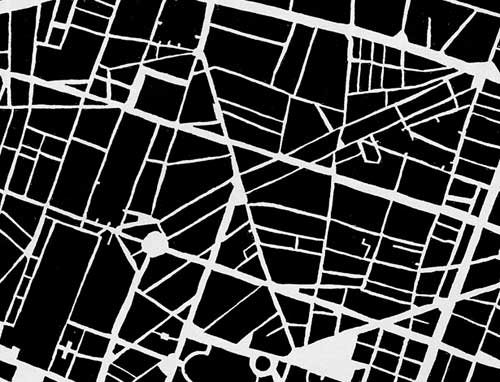
PARIS: “Streets were designed by Georges-Eugne Haussmann”
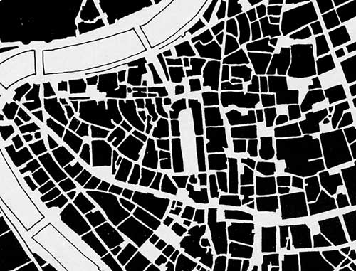
ROME: “East of the Tiber River bend that points to the Vatican”
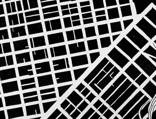
SAN FRANCISCO: “Market St splits the central city into two grids”
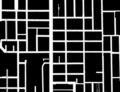
TORONTO: “Between Queen and College Sts east of Bathurst”