urbanism – landscape – ideas – theory – whimsy

Champs-Élysées goes green, literally

Photo: Xavier Defaix for Nature Capitale (via Flickr)

The Avenue des Champs-Élysées was recently temporarily turned into a green oasis for a weekend for Nature Capitale, a gigantic art installation by “street artist” Gad Weil (who also turned the Champs into a huge field of wheat 20 years ago) and the visual artist and landscape artist Laurence Medioni with the help of agricultural and forestry professionals which was created as part of a protest by young French farmers angry at their increasingly difficult economic situation beset by falling incomes. It is an attempt to reconnect Parisians with the countryside and includes 150,000 plants covering more than 3 hectares of the avenue, as well as sheep, pigs and cows held in pens.

This brings to mind the temporary turfing over of Trafalgar Square in London I posted about in 2007 but is so much bigger and way more impressive.

Photo: fabiengelle on Flickr

Compare this to a normal day on the Champs (below), and you have to wonder why it shouldn’t be a green oasis every day!

Photo: Champs-Elysees on a normal day (from Daily Mail)

Demolition of Tianjin’s old city

Google Earth imagery of the old city of Tianjin in November 2000 and January 2004

Google Earth imagery of the old city of Tianjin in November 2000 and January 2004 (move over image with your mouse to reveal After image)

Mass demolition of old districts is something of a “normal” thing in China, but to people who imagine that the large-scale destruction of historic city centres is a thing of the relatively distant past, the fate of Tianjin’s old chinese city serves as a sobering case. As Google Earth imagery shows, between November 2000 and January 2004 almost the entirety of the area within the old city walls (defined by the large roads forming a horizontal rectangle that replaced the walls), and a considerable part of historic districts outside the walls, was destroyed. Apart from a couple of important temples, hardly a building escaped the destruction. Between 2004 and 2009 the entire area was rebuilt primarily with high-rise residential buildings and a grid of large wide avenues (see 2009 airphoto below).

Google Earth imagery of the old city of Tianjin in May 2009

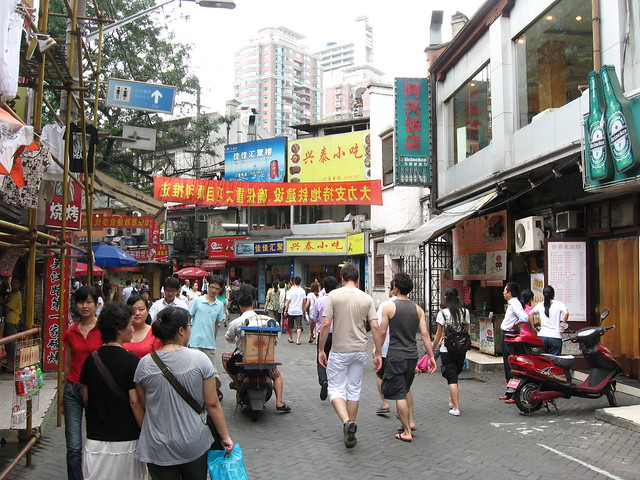
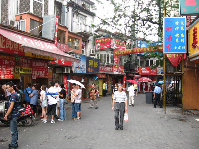
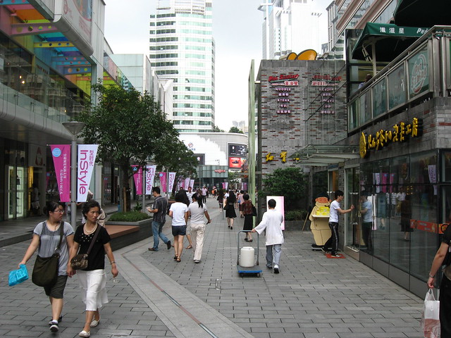
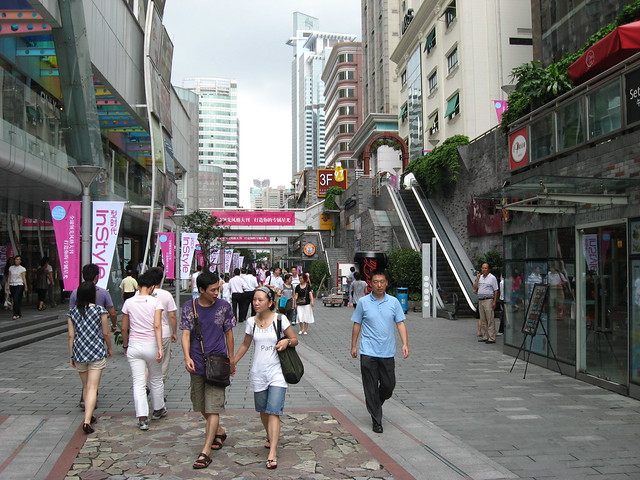
Two streets were rebuilt (not preserved) as “historic” streets in faux Qing style architecture – in the airphoto you can clearly see that the size and roofs of these buildings are not those of the original old buildings, and this type of street is certainly not unique to Tianjin, nor is the concept of demolishing a historic district and replacing it with a sanitized disneyfied historical recreation. Below in the central detail area you can also see the incredibly fine grain of the original historic city fabric.

Google Earth imagery of the old city of Tianjin in November 2000 and January 2004

Google Earth imagery of the old city of Tianjin in November 2000 and January 2004 (move over image with your mouse to reveal After image)

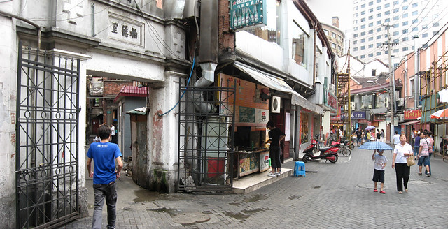
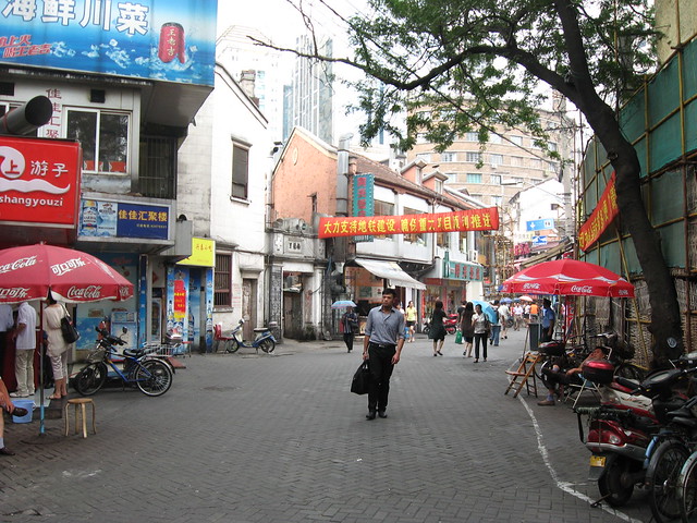
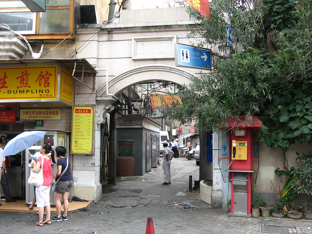
East of the old city walls was an old commercial district along the Hai River, now home to something called “Ancient Culture Street”, but again you can clearly see from the 2000 airphoto (see rollover below) just how much of the historic fabric has been preserved (one temple and 6 courtyard warehouses along a lane). Even Beijing has been guilty of this attitude towards a “historic” street in the Qianmen St “renovation” which includes an “old tyme” streetcar route and restaurant staff dressed up in Qing dynasty costumes.

Google Earth imagery of the old city of Tianjin in November 2000 and May 2009 (move over image with your mouse to reveal After image)

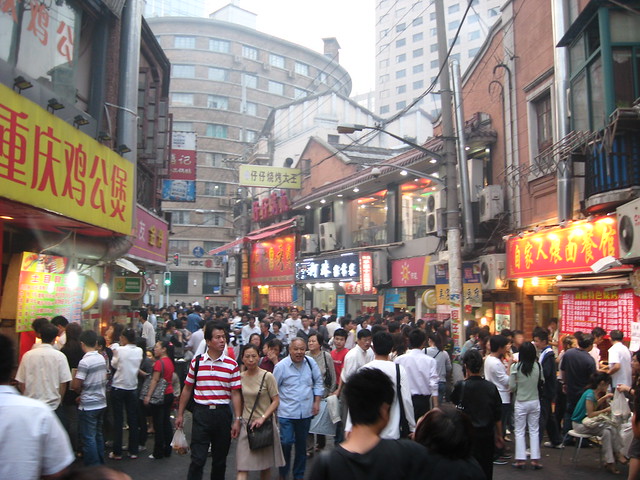
It seems pretty odd (but fairly typical in China) to have a city concerned to display and exploit its historic pedigree, while at the same time indiscriminately demolishing its own genuine heritage. The reasons are certainly complex and numerous, but foremost among them seems to be a perception that the actual heritage is not nearly impressive or valuable enough to warrant saving, nor, if saved, would give the city’s history the requisite prestige, dignity and respect. Most chinese cities seem to have decided that as far as both tourists and city residents are concerned, it’s far more popular, profitable, and prestigious to create sanitized reproduction tourist traps.

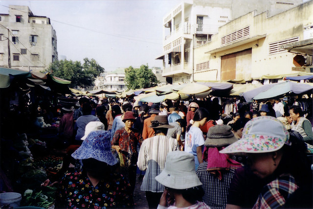
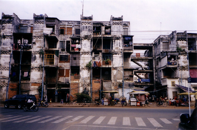
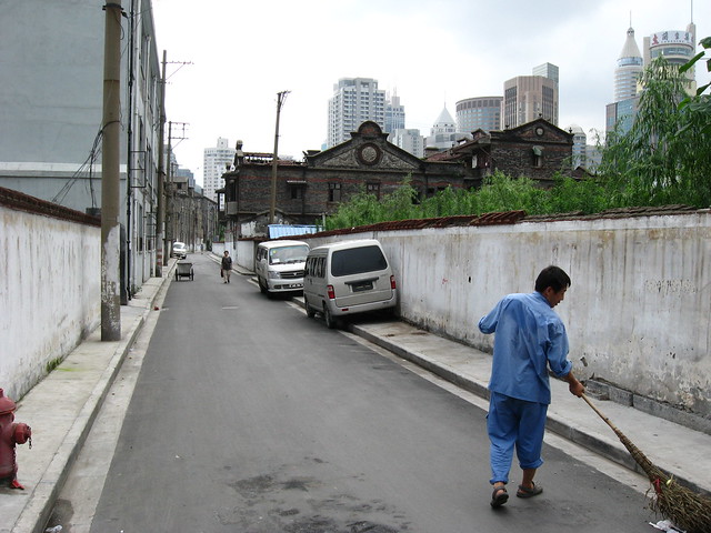
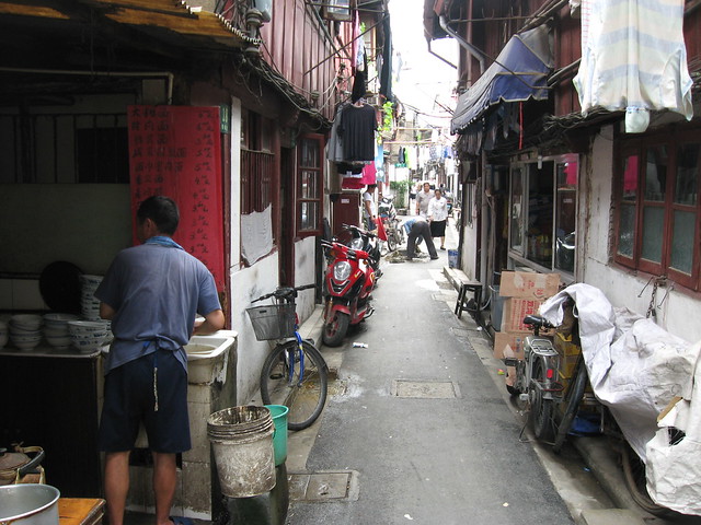
Of course, the excuse of “face” may just be masking a deeper reason for demolition and development: money. Many current residents of the overcrowded, underserviced and dilapidated buildings in older districts tend to be eager to receive the government rehousing compensation that comes from the repossession of their homes, giving them the opportunity to move into more humanely spacious and serviced modern apartments. Meanwhile, the government is just as eager to earn the profits from selling (or should we say flipping?) the repossessed and cleared land to the highest bidding developer. Needless to say, the profits available from renovating buildings within the existing fabric would fall far short of those from even relatively low-density redevelopment, and given that there are no property taxes in China, cities are basically forced to make money from land sales. Meanwhile, the compensation for the original residents tends to allow them to buy cheap apartments far out at the edges of the city, while the property prices in the older districts inflate endlessly beyond the reach of even many of the middle class.

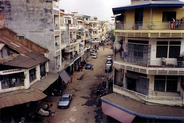
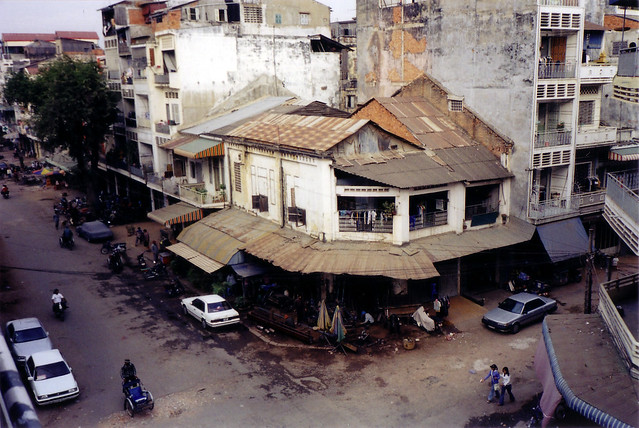
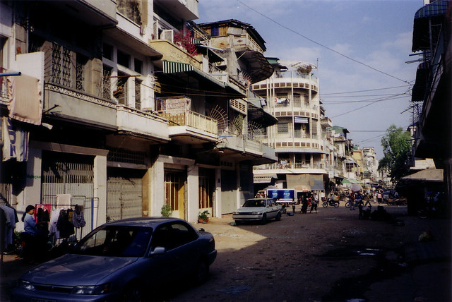
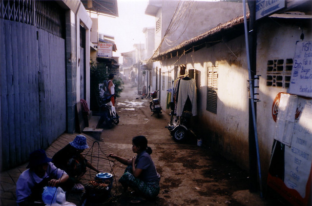
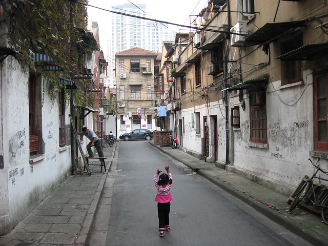
Further complicating the situation in Tianjin is the city’s history (or in this case, lack of ancient history). As history in China goes, Tianjin’s 600 years of establishment (at least as a walled, officially recognized city) pales in comparison to most chinese cities. Then, like Shanghai, Tianjin was opened up to foreign concessions in the 19th century and the history of the chinese city essentially was overshadowed from that point forward. As a result, the many western buildings of the former foreign concessions have been seen as far more valuable than the messy, dilapidated, overcrowded chinese city.

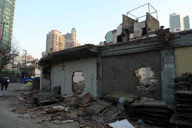
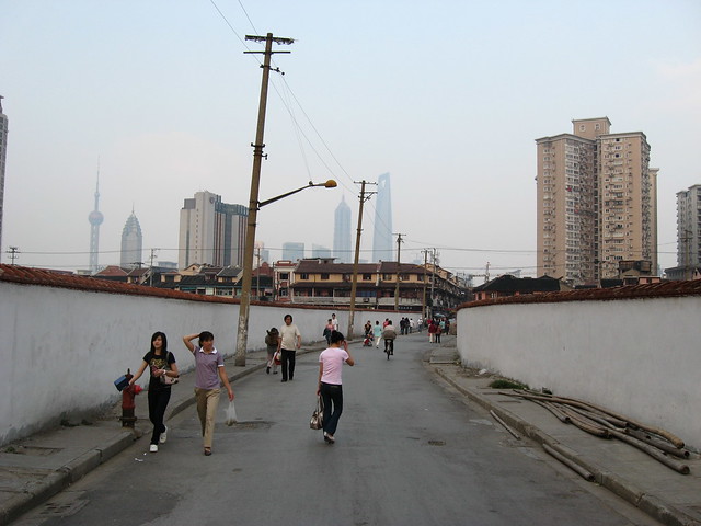
Regardless of the reasons, the end result is the same: widespread demolition of whole districts, destroying hundreds of years of history. The scale of the destruction can be so huge, it makes you wonder if the city has been bombed during a war or experienced some horrendous natural catastrophe. Alas, no, this is a wholly manmade and peacetime catastrophe of epic proportions.

Google Earth imagery of area north of the walled old city of Tianjin in November 2000 and May 2009 (move over image with your mouse to reveal After image)

Image 01Image 02
Image 03Image 04

Requiem for Wujiang Lu food street

Wujiang Rd Demolition

Wujiang Rd Demolition Before-After 1 (move over photo with your mouse to reveal After photo)

The remaining original portion of Wujiang Lu (吴江路) food street (east of Shimen Yi Lu 石门一路) is being demolished. The pedestrian food street has (or soon to be had) a very distinctive (dare I say delicious) curve to it which may be disappearing forever once demolition is completed. I previously reported on the contrast between the character of the food street and the earlier redevelopment of the portion west of Shimen Yi Lu and gave some history of the street itself. This post however is more about reflecting on yet another loss for Shanghai’s streetlife, so here are some before/after photo rollovers I’ve prepared (so we can kick it like it’s 1996) – first photos were taken around dinner time in October 2008 when it was absolutely crowded, rollover photos are from February 2010 in the midst of demolition.

Wujiang Rd Demolition

Wujiang Rd Demolition Before-After 2 (move over photo with your mouse to reveal After photo)

And another from further east:

Wujiang Rd Demolition

Wujiang Rd Demolition Before-After 3 (move over photo with your mouse to reveal After photo)

And another from nearer Shimen Yi Lu:

Wujiang Rd Demolition

Wujiang Rd Demolition Before-After 4 (move over photo with your mouse to reveal After photo)

Below you can access my Flickr set slideshow “Requiem for Wujiang Rd” that I made as an act of remembrance – you can see full size versions of these before-afters as well as other photos of Wujiang Lu before demolition began, and some video compilations at end.

Wujiang Lu (吴江路) Requiem

Below you can access my Flickr set slideshow of photos during demolition of Wujiang Rd and the small lane neighbourhoods to its north and south (the two videos below also appear at the end).

Wujiang Lu (吴江路) Demolition

I made a couple of videos walking through Wujiang Lu and the small lane district on its south side on February 24th 2010, (Flickr only allows 90 second videos so it’s split it into two parts). See below (note, videos have music).

In google earth you can see what will become of Wujiang Lu by comparing the fate of the lane neighbourhood to the south that was demolished sometime after November 2006 – see before/after mapping below (Wujiang Rd is the curving lane through the top part of the neighbourhood):

Google Earth Imagery of Wujiang Lu area in 2006 and 2009

Google Earth Imagery of Wujiang Lu area in 2006 and 2009 (move over image with your mouse to reveal After image)

I won’t comment too much about this because it makes me too angry and sad to see something that was so popular and fascinating wiped away for more bland corporate anywhere urbanism.

Image 01Image 02
Image 03Image 04Image 05

Shanghai’s metro during rush hour

Three videos to show the kind of crowd volumes that Shanghai’s People’s Square metro station (interchange for lines 1, 2 and 8 ) experiences during a typical rush hour – the unending sea of people is slightly mind-boggling, but by keeping with the flow an enormous number of people can peacefully get from A to B (the story on the platforms when the train doors open is a lot less peaceful). Click on the HD button to get higher quality video when viewing fullscreen.

Phnom Penh in 2004

DSCF2202-scan

Dilapidated streets and buildings in Phnom Penh, January 2004

These photos from scans of film prints of Phnom Penh in Cambodia from January 2004 show the unique dilapidated atmosphere of the city at the time. My digital camera had broken while at the Angkor temples but luckily I had my mini film camera as backup (also see post on a Thai market square). I recently read that significant new development is starting to happen in Phnom Penh (or at least be proposed), so I imagine that the city will start changing at a more rapid pace, but one hopes that before that happens they at least have gotten a handle on basic maintenance of the public infrastructure and cleaned the detritus from the less major streets with some frequency… perhaps the lingering smell of sewage is no longer pervasive. Despite all that, Phnom Penh has this amazing character that hopefully will shine through whatever changes the city is going through.

Browse more photos of Phnom Penh here at bricoleurbanism.org

…or at Flickr on my Phnom Penh Flickr Set

DSCF2200-scan

Dilapidated streets and buildings in Phnom Penh, January 2004

DSCF2203-scan

Dilapidated streets and buildings in Phnom Penh, January 2004

DSCF2205-scan

Inside Kandal market in Phnom Penh, January 2004

DSCF2224-scan

Sisowath Quay along the Tonle Sap River, including FCC Building (Foreign Correspondents Club), Phnom Penh, January 2004

DSCF2210-scan

Phsar Thom Thmei (aka Central Market), opened in 1937, modernist concrete Art Deco style, Phnom Penh, January 2004

DSCF2212-scan

Small lane next to Boeng Kak Lake, Phnom Penh, January 2004

DSCF2230-scan

A building off Blvd Samdach that looks something like a vertical slum, Phnom Penh, January 2004

Unblocked in China!

401_3672-edit

View towards Oriental Pearl Tower from Times Square on Huaihai Zhong Lu, Shanghai

Finally this site is unblocked in China! I figured out that if I pay extra per month to get a dedicated IP address, I can (with luck) avoid the blanket blocking on Godaddy’s shared hosting IP addresses without the annoyance of switching hosting providers.

To celebrate, I’ve made a few changes to the site.

The posts of photos in PaD Shanghai and From the Vault are no longer cluttering up the other posts in the main site – they can be accessed directly alone from the sidebar at right, and each has its own RSS feed to subscribe to.

The main body is now wider allowing larger more glorious photos.

Day in the Life of a Market Square in Thailand

DSCF2246-scan

I was scrummaging around my hard drive and came across some scans I had done of film prints of Cambodia and Thailand from January 2004 but hadn’t cleaned up and catalogued. My digital camera had broken while at the Angkor temples in Cambodia but luckily I had my mini film camera as backup. While relaxing for a couple of days in the small Thai town of Trat near the Cambodian border (to recover from the intensity of Cambodia and the gruelling road trips in and out), I managed to get some shots of the amazing transformations of the town’s market square through the course of a day.

In the morning there’s a fairly intense wet market (for fruit, vegetables and meat), with temporary stalls with all kinds of umbrellas and canopies for protection from sun and rain. Later in the day, the wet market closes and disappears and the market square gets cleaned up and sits there empty. Then in late afternoon, the night market starts to set up with food stalls with patio furniture seating, some fruits, vegetables and dry goods. The night market runs right through the evening with a great variety of dishes available from a multitude of stalls and a fantastic outdoor eating and drinking atmosphere.

While to a casual observer it seems a bit chaotic, it’s clearly highly organized and well managed – there are even painted lines on the square surface organizing the setup. What’s most striking is how this compares to the ridiculous way some Western public squares such as Dundas Square or Nathan Phillips Square are managed, with corporate events and advertising, overbearing security, and any lively activities like what takes place in Trat every day confined to strict and infrequently programmed “events”.

DSCF2244-scan

The morning wet market of temporary stalls, Trat, Thailand

DSCF2247-scan

The morning wet market of temporary stalls viewed from above, Trat, Thailand

DSCF2252-scan

After the wet market closes, the empty market square, Trat, Thailand

DSCF2269-scan

Setting up the night market of food stalls in late afternoon, Trat, Thailand

DSCF2242-scan

Night market of food stalls in early evening, Trat, Thailand

DSCF2270-scan

Night market of food stalls after dark, Trat, Thailand

Old Town Shanghai

401_2166-pan

Danfeng Lu between Wutong Lu 梧桐路 and Fangbang Zhong Lu, Nan Shi 南市 (Southern City, Chinese Old Town)

A misunderstood and underestimated side of Shanghai, the “Chinese Old Town” (called Nan Shi 南市 or Southern City by locals) is the truly historic district of this complex and cosmopolitan city, with the street fabric and many buildings far predating any of the development of the Concessions while controlled by the foreign powers.

401_2076

Anren Lu behind the east wall of Yuyuan Garden

Frequently (and erroneously) dismissed as simply an insignificant “fishing village” before the area was opened to foreign trade by the Nanjing Treaty of 1842, Shanghai was in fact already a significant Chinese port and trading city with as large (or greater) a volume of shipping as contemporary London (at least according to Lynn Pan in “Shanghai Style: Art and Design Between the Wars“). The core of the city was surrounded by a 5km circle of walls built in 1553 to protect against Japanese pirates, the line of these walls is preserved today by a circle of streets built after their demolition (Renmin Lu and Zhonghua Lu). Outside the walls running down to the Huangpu River was a large commercial, warehouse and port district, with a “forest of innumerable masts” at its wharves.

400_3437-pan

A remnant building that's survived demolition in a large cleared district of demolished buildings off Qinglian Jie and Wanzhu Jie

401_2205

Same building 8 months later with empty site now a forest of weeds

Sadly, today large areas of the Old Town have been demolished and the former walled city is divided into 4 parts by two large traffic arteries cut through its fabric (Henan Nan Lu and Fuxing Dong Lu). Worse still, its position as the historic origin of a great trading city is largely forgotten or ignored: many tourists simply visit the heavily restored and questionably antique Old Street (Fangbang Zhong Lu east of Henan Nan Lu), Yuyuan garden and pastiche tourist-trap Yuyuan Bazaar and feel they’ve “hit” the Old Town; expats are generally too enamoured with the faded glories of the French Concession to bother with it; and most locals seem more embarrassed by the Old Town than anything else, barely admitting to its existence, as though it doesn’t live up to the hype that is Shanghai, either its past glories or its future potential.

401_2133

Wutong Lu 梧桐路 between Danfeng Lu and Baodai Nong

But they don’t know what they’re missing, because the Chinese Old Town (as one would expect) is one of the few places in Shanghai where you can experience a truly Chinese urbanism and a genuine taste of what the city was like before the foreign devils forced their way in. Significant areas still survive filled with lively streetlife, small twisting lanes, and endlessly fascinating visual stimulation of a thoroughly different kind than in the historic lilongs of the French Concession. How much longer this old fabric will survive is anyone’s guess since most of the architecture is undervalued by locals in comparison to buildings such as Shikumen housing in the foreign concessions, and the fine street network is particularly unsuitable to high density redevelopment resulting in whole districts being levelled to create large parcels, with no trace of the hundreds of years old fabric beneath. Only time will tell how much of what remains will survive and in what form, but so far there seems to be relative restraint from officials compared to other districts of the city with regard to the upcoming 2010 Expo. I remain hopeful they will pursue a renovation/revitalization approach addressing living standards and servicing rather than the wholesale demolition that has been all too common in Shanghai.

Browse more photos Old Town Shanghai here at bricoleurbanism.org

…or here on my Old Town Shanghai Flickr Set

400_3431

Dajing Lu west of Luxiangyuan Lu with cleared sites of demolished buildings for development behind the walls

400_3461

A lane north off Fuchan Nong

Wujiang Lu: Past, Present & Future

401_1964-pan

Wujiang Lu food street, near Nanjing Xi Lu station

Wujiang Rd (吴江路) is a small street in Shanghai that has gone through several transformations in its history, from a den of vice, to a popular food street, to a high-end pedestrian “leisure” street. Situated in Jing’an district just off Nanjing Xi Lu near the subway station on Line 2, the street’s origins lie sometime before the 1860’s when its winding path following a creek made such a convenient shortcut that it became Shanghai’s first toll road and was known in chinese as Diamond Bridge Rd.

401_1958

Wujiang Lu was (rather ironically) called Love Lane when it was part of the International Settlement and was notorious from the 1920’s as a den of brothels and vice unparalleled even in the Shanghai of the time. “Despite its romantic name, everything was for sale on Love Lane.”

401_1972

At some point in later decades Wujiang Lu became a very popular food street with crowds of locals jostling for cheap treats from all over China. Unlicensed stalls lined the pedestrianized street competing with the small restaurants, some of them quite famous.

401_1954

"Wujiang Road Leisure Street" west of Shimen 1st Rd

Then along came the spectre of Expo 2010 and a very strong government desire to “clean up” places like Wujiang Lu. The section of the street west of Shimen 1st Rd was entirely demolished and replaced with “Wujiang Road Leisure Street”, a new pedestrian street of fashion boutiques and chain restaurants, a dull corporatized pedestrian mall. In events very typical of current chinese redevelopment, a place abounding in street life and food and shops affordable for most chinese locals has been replaced with expensive shops and restaurants targeted at the nouveau riche.

401_1949

401_1953

The section of Wujiang Lu east of Shimen 1st Rd has survived so far, but it seems has been cleaned up a lot and the unlicensed vendors removed. It’s unclear whether or not the short remaining block still has demolition looming over its head.

401_1971

401_1975

401_1976

History in the Junction: Part I

290_9005

Knesseth Israel Synagogue (also called “The Junction Shul”) at 56 Maria St in the Junction in Toronto just off Dundas St W. The building was built starting in 1911 and  is a designated heritage building and also has an Ontario Heritage Foundation plaque.

The building dates from a time when the Junction was a key centre of industry for Toronto, drawing many working class immigrants to the plentiful jobs.

The historical plaque reads:

“The Junction Shul” was founded early in the 20th century in a building at the corner of Maria St and Runnymede Rd, with a congregation primarily of Polish and Russian Jews. As the congregation grew, construction of this building began in 1911 and it appears that services were first held here about 1913. Designed by the architectural firm Ellis and Connery, the exterior is simple and the interior evokes the splendour of Eastern Europe. Typical of orthodox synagogues, the hall of worship faces toward Jerusalem. The circular windows are divided into eighteen segments, the numerical value of the Hebrew word for life, “chai”. This is now the oldest purpose-built synagogue building in Ontario still in use as a synagogue.

The dedication reads:

“This plaque donated by Joey and Toby Tanenbaum in loving memory of our grandparents Abraham and Chipa Sura Tanenbaum, September 2001”

290_9006