Back in Toronto
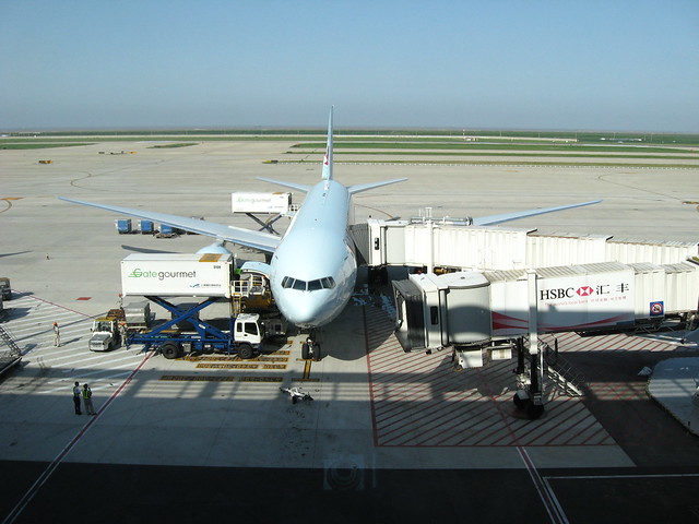
My plane waiting at terminal 2 at Pudong International Airport in Shanghai - Boeing 777 I think
Back in Toronto for a visit, so PaD Shanghai is on hold for now – in lieu I’ll be presenting some older miscellaneous photos.
My plane waiting at terminal 2 at Pudong International Airport in Shanghai - Boeing 777 I think
Back in Toronto for a visit, so PaD Shanghai is on hold for now – in lieu I’ll be presenting some older miscellaneous photos.

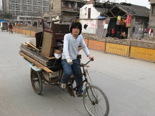
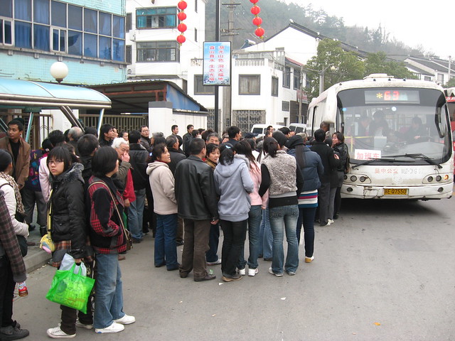
Despite dramatic decreases in the number of cyclists in Chinese cities over the past 15 to 20 years, transport of goods and products, informal collection of recycling, deliveries and use of bicycles for retail and selling is still very common.
I’ve uploaded a photo gallery (Flickr set) of some of this activity easily seen in Shanghai. While Shanghai is in many other ways a very modern and advanced city, the continuing use of bicycles for so many purposes seems directly related to the presence of so many people willing (or forced) to work for extremely low fees, for which the bicycle remains by far the cheapest and indeed the only affordable means of transportation. Especially over short delivery distances, it would seem to many Chinese almost wasteful to use a truck.
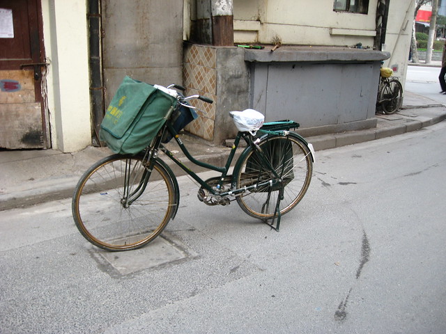
One of the few official agencies still using bicycles is China Post, whose beautiful green delivery bicycles (complete with panniers) can frequently be seen parked in front of buildings.
Shanghai’s waterfront is synonymous with its history. The archetypal image of Old Shanghai is a view of the city’s former front door, the storied Bund along the Huangpu River, lined with ostentatious colonial banking and commercial buildings, symbols of Shanghai’s bizarre history of foreign control and profiteering. For New Shanghai, you simply have to turn your view across the River to Pudong, where a profusion of skyscrapers have sprouted on what was docks, warehouses and fields only 15 years ago, giving Shanghai as modern a skyline as anywhere.
Pudong Skyline from the Bund
Historically, the Bund was characterized by having an old port’s chaos of ships, wharfs, docks and cargo on the water side, and the dignified solidity of the city’s prime address on the other. In the past, this waterfront vibrancy tended to be the rule rather than the exception, but Shanghai took the activity to a delightful extreme with streetcar routes and plenty of promenaders on both sides of the street. Even so, you can clearly see parallels with historic views along the Old Port in Montreal, and doubtless many other cities.
 Source
The Bund in 2006: 10 or 11 lanes of uncrossableness, including a raised median to stop anyone crazy enough to try jaywalking - I'm not sure if the trees will be saved
Unfortunately, Shanghai’s waterfront Bund is today a pale shadow of its former self. As in so many other cities, the waterfront was eventually seen as the easiest place to put a major cross-town traffic artery – in this case, at grade, though with a large flyover (now demolished) connecting to an elevated expressway. Ten or eleven lanes of through traffic later, the waterfront promenade that is such a major tourist attraction is as separated from the famous buildings that line the Bund (and the narrow sidewalk in front of them) as possible. At-grade pedestrian crossings are essentially outlawed for the entire length of the historic area, with pedestrians forced into underground tunnels to cross to the waterfront (a temporary pedestrian overpass during construction shows how wonderful it is to see what you’re crossing). Exasperating the strange and tenuous connection between the two sides is the elevation of the waterfront promenade a few metres above street level (something that seems to have been done for flood control reasons).

View along the Bund from the temporary pedestrian overpass during construction in 2009
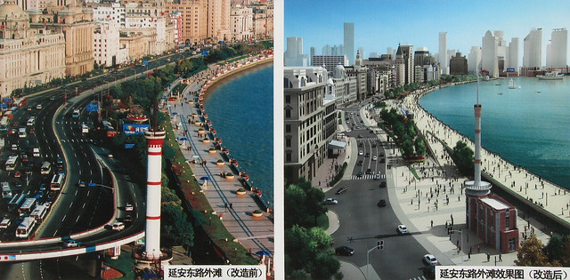
Before and after views of the Bund revitalization, from a poster on a street near the waterfront
Happily, changes are afoot that will be attempting to address some of the Bund’s deficiencies. Firstly, the major traffic artery is being placed in a tunnel below ground level in a huge engineering project which will leave only four lanes of traffic at grade. The Bund will be streetscaped as an urban avenue, with at-grade pedestrian crossings, trees and a much stronger connection between the two sides of the street. The raised promenade along the river will remain elevated (I presume that flood control precludes any change to that), but a series of ramps will tie it much more closely to the street and grade level of the buildings of the Bund. Clearly the proposals will be a strong step in the right direction for an urban locale that is high on the agenda for every tourist that visits Shanghai. One also hopes that reconnecting the waterfront promenade to the city this way will also encourage ordinary Shanghainese to visit more easily.
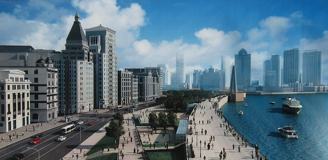
View of proposed changes of the Bund revitalization, from a poster on a street near the waterfront
Still though, it’s hard not to be a little nostalgic for the chaos, bustle and business of the old Bund. Somehow a tourist-oriented waterfront promenade choked with package tourists, silly crap for sale to tourists, and potential scams and scammers to watch out for doesn’t quite compare. Hopefully the revitalization scheme, if successful, will help to add a little more action simply by tying the promenade back to the city and encouraging a wider diversity of users. However, a view of what might have been can be glimpsed through a couple of photos found on Flickr showing the Bund in 1983 and 1984 (see below) – a beautiful tree-lined boulevard that looks like it might have compared well to the great waterfronts of the world. It’s rather funny that today Shanghai is desperately trying to get back to where it was 25 years ago when it comes to its most recognizable and impressive urban space. It’s also amusing that despite a building boom of unbelievable scale, and skyscrapers in lots of silly shapes and sizes, the waterfront that has defined the image of the city since the establishment of the international concessions continues to outclass them all.
A Valentine’s Day trip to Suzhou for a cherry blossom festival (yes cherry blossoms were out on February 14th!) – it was an exercise in trains, taxis, rickshaws and tuktuks that started off with a subway trip to Shanghai Railway Station to catch the bullet train to Suzhou (train tickets cost 26RMB / US$3.75 each way):
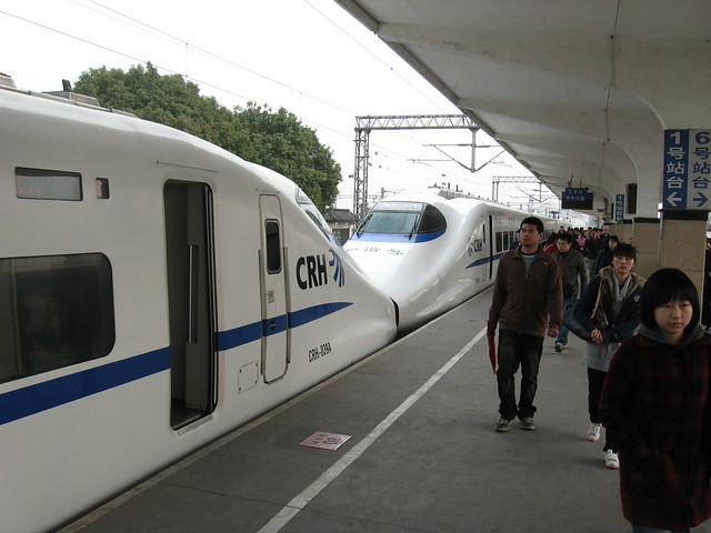
Bullet train from Shanghai Railway Station to Suzhou, about 40 minutes - these trains are 16 cars long and are essentially 2 trains coupled together - this is the joint between the two trains
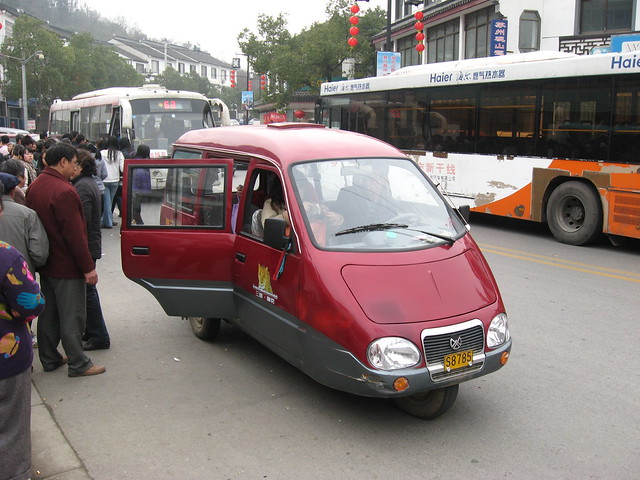
Why travel by 4 wheels when you can travel by 3? The one we took was an older model in much worse shape than this one
Ohoh... we have to get on this bus to get back to Suzhou (maybe 1.5hr ride!)... to shove or not to shove that is the question!
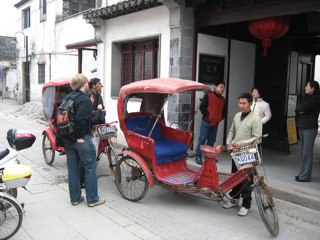
Arriving by tricycle rickshaw at the main entrance of the exquisite Garden of Cultivation (Yipu Yuan) at 5 Wenya Lane in the NW corner of Suzhou's old city
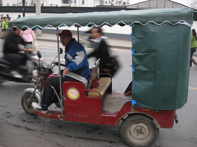
Motorcycle richshaw/tuktuk back to the train station, four of us hanging on for dear life as we hustle through some of Suzhou's tiny streets taking a shortcut
Note: the photos are geotagged in Flickr so you can track the trip, however Flickr uses yahoo maps whose China mapping and airphoto coverage is very poor at the moment
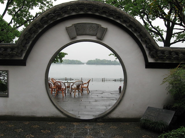
West Lake in Hangzhou, China from one of the gardens along its edge.

August 2008 - Band shelter and (temporary?) public space
An interesting evolutionary space has been created in the Junction on a vacant lot where some retail buildings were demolished in 2007. The empty site (which was originally being advertised as a “New Retail Development Build-to-Suit Opportunity”) was rehabilitated as an outdoor stage venue (the “Junction Train Platform”) as part of the centennial celebrations commemorating 100 years since the former City of West Toronto was incorporated. The (I think temporary) space has been outfitted with some seating and temporary plant material and seems to be a pretty popular place for people to relax and have a conversation. Behind the potted evergreens at the back I think are some parking spots. It’s a great use of what was essentially a barren, desolate gap in the urban fabric! More on the City of West Toronto Centennial celebrations, West Toronto Junction Historical Society and The Junction BIA.

August 2007 - "New Retail Development Build-to-Suit Opportunity"

March 2007 - Buildings in process of being demolished
A BBC television series called Britain From Above will be using GPS “satellite tracking and groundbreaking computer imaging” so we can “watch for the first time on television the great migrations across our landscape” that is the “unseen ballet of Britain”. This video teaser includes tracking the routes of shipping in the English Channel, taxicabs in London, tracking aircraft movements and telecommunications traffic!
Awesome!
A slightly better quality version of same video is available on the BBC’s site.

Map: Free Wifi Zone in Montreal's Old Port
I hope WaterfronToronto is paying attention – here’s a map of the free wifi zone (via sponsors) at the waterfront in Montreal’s Old Port (source). The zone was set up for and is under the jurisdiction of Les Quais du Vieux-Port (The Quays of the Old Port) – a 47.3-hectare (117-acre) territory with 2.7 kilometres of St Lawrence River waterfront – which is itself an entity created and managed by the federal agency in control of the entire Old Port, Société du Vieux-Port de Montréal (Old Port of Montreal Corporation).

Photo: Panorama of Montreal's Old Port
Apparently Telus is the sponsor responsible for providing the actual wifi service, with other sponsors covering the costs. While some of us might prefer that something like Wireless Toronto (a volunteer-run not-for-profit community group dedicated to setting up free wifi hotspots around the city) were the one’s running something like this, the size of Montreal’s wifi zone would probably be too infrastructurally complicated and expensive for a small group like Wireless Toronto. Wireless Toronto have set up one of their hotspots at York Quay at Harbourfront Centre, though it’s fairly geographically limited. One of the most interesting aspects of Montreal’s zone is how the two marina areas are deliberately included allowing wifi access from moored boats! Toronto Hydro’s One Zone wireless network (which covers most of the downtown area) is not free and does not currently cover any part of the waterfront, and I think it’s the wrong model to pursue for the waterfront. I think free wifi on the waterfront would be a great way to encourage waterfront users of all kinds, and would be the kind of forward-looking optimistic project we really need to kick off the “idea” of the waterfront revitalization.

Photo: Old Port of Montreal from the air
However, we should be a little careful when we look at the Montreal model – the Old Port area controlled by the Corporation is federal land, but being owned and operated by the Corporation actually means it is not technically public space. There are in fact a list of “site rules“, buskers and other entertainers are auditioned and require permits (as with many other tourist areas), leafletting and soliciting are not allowed, “activities may not be held or promoted on the site without permission” and “filming or photography for other than personal use must be authorized”. These are dangerous precedents for Toronto’s waterfront – while this post has mostly been about free wifi, I think the principle of freedom needs to additionally extend to the use of public space at the waterfront.
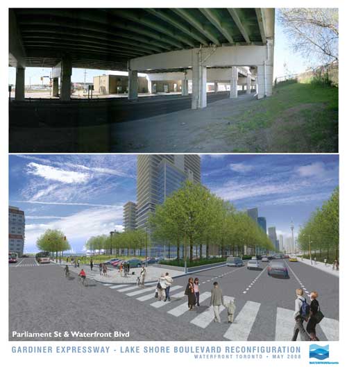
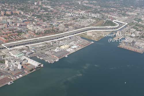
In an announcement with significant ramifications for the waterfront, the much-maligned Gardiner Expressway is to come tumbling down…. at least part of it. Waterfront Toronto, the City and the provincial Ministry of Public Infrastructure Renewal together appear to have stumbled into a momentous decision with the removal of funding for the Front St Extension and the (resulting?) decision to demolish the portion of the Gardiner from east of Jarvis to the Don Valley Parkway.
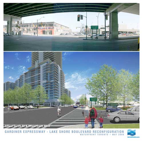
In these images released today, Waterfront Toronto gives us an idea of what the demolition of the Gardiner may mean at street level. And frankly, if this is the way it’s handled, it looks fantastic – with the added benefit (not shown in the renderings) that the railway corridor is not as wide by the time it gets to Jarvis, meaning there could be a window of hope for a relatively pleasant passage down to the lake for the East Side, all of a sudden making Waterfront Toronto’s proposed developments at West Don Lands, East Bayfront and in the future at the portlands, seem far more connected and potentially vibrant. Could this be a great day in the history of Toronto’s waterfront?
Hold your horses there…. I’m not so sure. While clearly this is a decision many of us have been gagging for for years (nay, decades!), in typical Toronto fashion are we bollocking up one of the most important decisions in the city’s planning history? While the renderings show a relatively tamed boulevard at grade (along the lines of University Avenue perhaps), the plan almost seems a slap in the face to the functionality of the Don Valley Parkway and the Gardiner combined. Now in a way it’s great that expressway functionality is not determining the decision making here, but this decision has huge ramifications on two very important roads that currently connect and essentially function as one road. While many will say “who cares”, what exactly are the expected traffic volumes on this at-grade road and how tamed and crossable will this really make it? I mean if it’s essentially a Gardiner at grade with a pedestrian signal every 5 minutes, I’m not so sure this is a good thing.
But apart from that, the mind-boggling, ridiculous, tear-you-hair-out frustration of this scheme is that if you’re making such a mess of the Gardiner and its “flow”, doesn’t it just make sense to demolish the whole damn thing while you’re at it (at least make it part of the plan to do so!)? Why on earth should the Gardiner remain above grade as it crosses the foot of Yonge Street, the most important damn street in the City and the Province, and come down at Jarvis? If you’re screwing up the Gardiner anyway, and the projected volumes are nice enough to cross at grade, then bring the whole damn thing to grade out at Strachan and open up Fort York to the lake, give City Place a chance to be an actual place, and dish out the benefits to the whole central waterfront while you’re at it.
But no. Just like Toronto to do something like this half-assed and (surprise, surprise) solely for the benefit of Waterfront Toronto’s proposed developments alone. Message delivered: central waterfront, go f**k yourself!
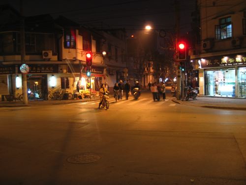
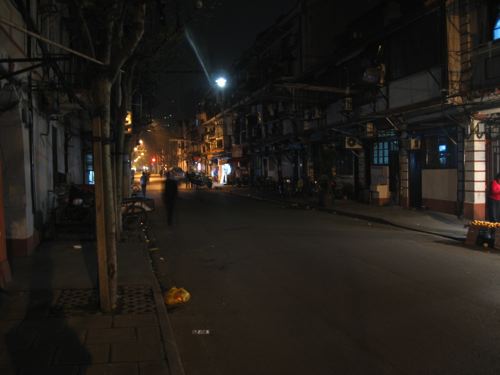
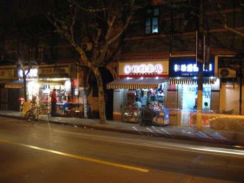
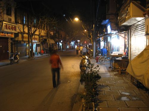
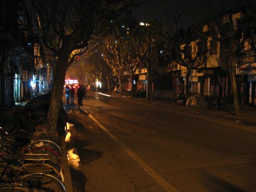
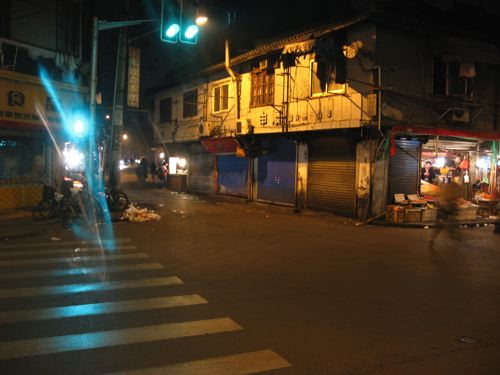
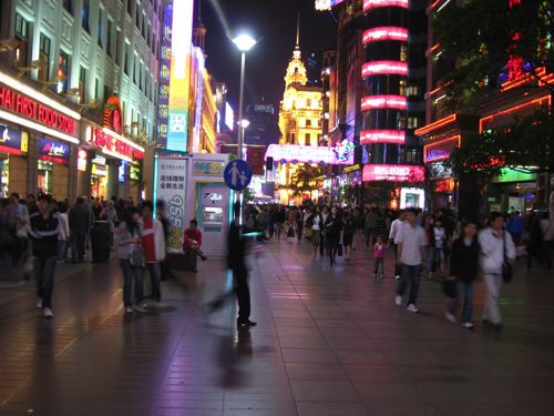
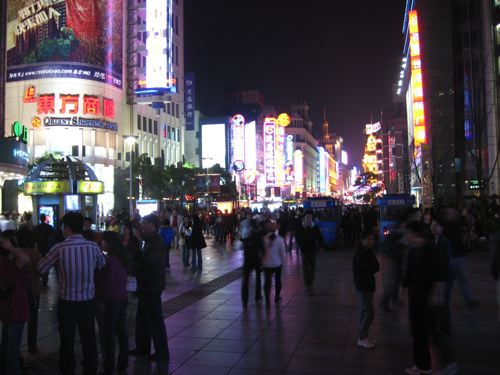
Just back from a trip to Shanghai, a beautiful (and unbelievably safe) city at night. A little taste of night life in some older districts, and at the end some night shots of the long pedestrianised part of East Nanjing Rd (Nanjing Dong Lu), “one of the world’s busiest shopping streets”.
More from Shanghai soon.


An ongoing series of reflections on the city, the landscape and the fields that manipulate them from the perspective of urban design, landscape architecture, Toronto and Canada.
Posts RSS
PaD Shanghai Photos RSS
From the Vault Photos RSS
Documentation
Plugins
Suggest Ideas
Support Forum
Themes
WordPress Blog
WordPress Planet


 - 6.2, 1983")
